

Lot 222 - A192 Books - Monday, 15. June 2020, 02.00 PM
Linschoten, Jan Huygen van.
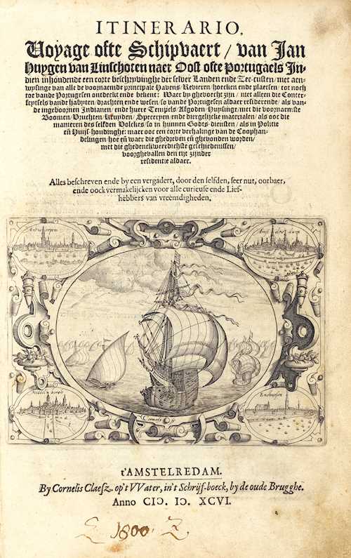
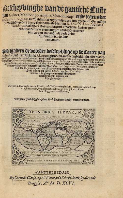
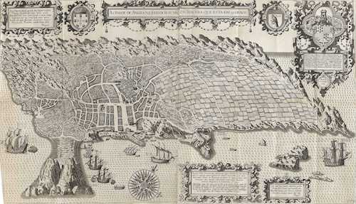
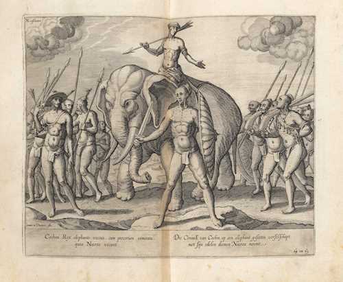
Itinerario, Voyage ofte Schipvaert naer Oost ofte Portugaels Indien inhoudende een corte beschryvinghe der selver Landen ende Zeen-custen. [...]. - Beschryvinghe van de gantsche Custe van Guinea [...]- Reys-gheschrift vande Navigatien der Portugaloysers in Orienten. 3 parts in 1 volume. With 1 engraved portrait, 3 (2 repeated) engraved title vignettes (including one with a world map by Hondius), 5 (instead of 6) engraved folding maps by van Langren and van Deutecom, 34 (instead of 36) engraved plates (30 double-page, 4 folding) by J. and B. van Deutecum after Linschoten.
Amsterdam, Cornelis Claesz, 1596 and (Reys-gheschrift:) 1595. Folio. [4] leaves, 160 pp, [41] leaves, [1] blank leaf, 147 pp, [4] leaves. Flexible contemporary vellum binding with manuscript title on cover in old hand and black stamped monogram "OSF" (somewhat dusty and stained, cover somewhat bent, back cover with small loss, ties removed).
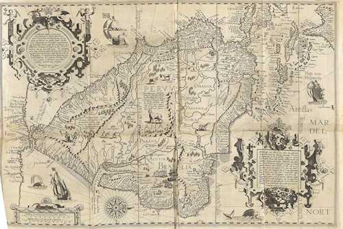
Sabin 41356 - Church 252 - Borba de Moraes I, 416ff. - Shirley 182 (vignette by Hondius) - Cat. Nederl. Scheepvaart Mus. I, 170 - BM STC, Dutch Books p. 118 - Walravens 10 - Parts, Mémoire bibliographique 83-91 - not in Adams. - First edition. - Lacking the large world map, the view of Goa (after p. 42) and the first map of St. Helena (after p. 140) - The existing maps are copies after early manuscript maps by Bartolomeus Lasso (1590). They show South America with the Antilles; the West Coast of Africa; the East Coast of Africa with Madagascar; the northern Indian Ocean with Arabia and India; as well as China and Indonesia. The plates with maps and views of St. Helena and Agra, also traditional dress and costumes, depictions of natives, ships, plants and animals. The title vignettes for Itinerario and Reys-gheschrift with (repeated) decorative ship depictions, with views of Antwerp, Amsterdam, Middelburg and Enkhuisen in the corners. The title of the Beschryvinghe with the Hondius world map in 2 hemispheres. - In 1581 Linschoten (1563-1611) went to India for six years, where he worked as secretary to the archbishop of Goa, Vicente Fonseca. This prominent position gave him access to the nautical charts of the Portuguese, who had kept them well guarded for over a century, and he secretly made copies of them. On the return trip to Lisbon, Linschoten reached the Portuguese naval base on the island of St. Helena in May 1589 and spent two more years in the Azores.
CHF 20 000 / 30 000 | (€ 20 620 / 30 930)
Sold for CHF 51 540 (including buyer’s premium)
All information is subject to change.